


 will be held in Guangzhou, Shanghai, Chengdu and Beijing")


A research collaboration between The University of Western Australia and the Australian Institute of Marine Science (AIMS) would make it possible to predict strong currents off the north-west coast, with future applications for industry, search and rescue, and conservation.
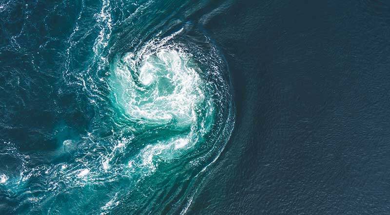
Currently, there is little information about swirling eddies, underwater waves and how the ocean responds to tropical cyclones in the region – dynamic ocean processes that cause operational problems for offshore industries.
Researchers from UWA and AIMS, who are partners in the ARC Research Hub for Transforming energy Infrastructure through Digital Engineering (TIDE), have recently taken steps to rectify these knowledge gaps by deploying sophisticated sensors and taking seawater samples in the Browse Basin, north-west of Broome in Western Australia.
The field work coincided with detailed mapping of the Browse Basin by the NASA/CNES (Centre National D’Etudes Spatiales) SWOT (Surface Water and Ocean Topography) satellite, launched in December 2022, and was carried out during its fast-sampling phase.
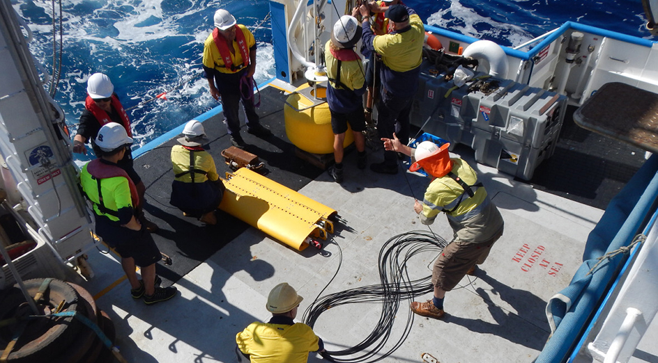
Image:The wire-walker is prepared for deployment to cllect data on turbulence, temperature, water clarity and chlorophyll. Photo credit: Andrew Zulberti, AIMS
The combined data set would be incorporated in ocean models to more accurately predict what is going on beneath the sea surface.
TIDE Deputy Director and physical oceanographer Professor Nicole Jones from UWA’s Oceans Graduate School said the goal of the project was to create knowledge and tools to guide decision making by those working in the Browse Basin, through enhanced understanding of the offshore marine environment.
“Strong currents in the region are variable and difficult to predict. They can range in scale from 100s of metres to 100s of kilometres, and can last for hours or days,” Professor Jones said.
“Available forecasts cannot predict these transient processes because up to now, we haven’t measured or mapped them closely enough.
“Our research will focus on determining how we can use the new SWOT satellite data to better understand these transient processes, leading to predictive models that bring more certainty and insights for organisations working in the region.”
AIMS project leader and physical oceanographer Dr Jessica Benthuysen said a team of scientists deployed instruments from AIMS Research Vessel Solander to measure ocean properties and currents from the surface to the ocean floor.
“This included a Vertical Microstructure Profiler which looks a little like a chimney sweep’s brush. The instrument measures fine-scale motions – turbulence – with very delicate probes.
“We also deployed moorings, which collected oceanographic data for six weeks.
“In the years ahead, the team will analyse the data and develop products that can be translated into tools for industry.
“Improved forecasting will help offshore operators achieve optimal operational decision making and ensure safety for their people and the environment.”
The TIDE Research Hub (www.tide.edu.au) was established in 2021 through funding provided by the Australian Research Council, a number of major industry partners, UWA and the University of Wollongong. AIMS are a partner in TIDE, along with other national and international organisations.